Wednesday 29 October 2014

Island 261 - Eilean Trenach, Port Ramsay, Lismore, Argyll

I thought I was going to have to break my own rule of not counting unnamed islands, as this island isn't named on the Explorer map.  However according to the Ordnance Survey Open Data website this small tidal island at Port Ramsay on the Isle of Lismore is called Eilean Trenach.

Eilean Trenach is linked to Port Ramsey by a 100 or so metre long shingle tombolo at low tide and for several hours either side of it.

The island is covered in rough grass and heather.  There are a few scrubby hawthorn and rowan trees and when I visited in September 2014 blackberries were in plentiful supply and devil's bit scabious was in flower.  The island is very boggy.  Presumably the local cows sometimes wander across when they fancy a change of scenery, as there were cow pats on the island.

 Eilean Ramsay from Eilean Trenach

 Eilean Trenach

Tombolo linking Eilean Trenach to Port Ramsay

Port Ramsay from Eilean Trenach

Island 260 - Bernera Island, Lismore, Argyll

Bernera Island is linked to the south west coast of Lismore by a rocky tidal causeway.  The causeway is covered in seaweed which was quite slippery.  I visited an hour and a half before low tide and the causeway was only about 6 metres wide at its lowest section.

There is an indistinct path down the south east coast but there are lots of small holes which aren't very visible and in which you could twist or break your ankle, so I didn't venture too far.  When I visited in September 2014 the island harebells and scabious were in flower and there were plenty of blackberries to eat.  Although there were cows grazing on the shore of Lismore adjacent to the causeway, there were no cow pats on the island.  There were however sheep droppings, so presumably they sometimes wander over at low tide.

There used to be an ancient yew tree on the island under which St Columba preached.  However it was chopped down in 1850 to make a staircase at Lochnell Castle on the mainland.

There was also a small chapel on the island but the remains of it have all but disappeared.

 North east coast of Bernera looking south west

Unusual rock formation
Lismore from Bernera Island - Achadun Castle can be seen on the horizon

 Lismore from the north east coast of Bernera Island

 Small cave on Bernera Island
 
 Unusual rock pillar

 Bernera Island from Lismore - seaweed covered tidal causeway

Bernera Island from Lismore showing the narrow tidal causeway

Island 259 - Lismore, Inner Hebrides

Lismore is a long thin island located in an area known as the Lynn of Lorn where the Loch Linnhe meets the sea.  It is about 10 miles north of Oban.    The island is just under 10 miles long and just under a mile wide.  There is one road running down the spine of the island with 5 short spurs off it.  The highest point on the island is Barr Mor at 127 metres, so it isn't one of the hilliest islands in the Hebrides.

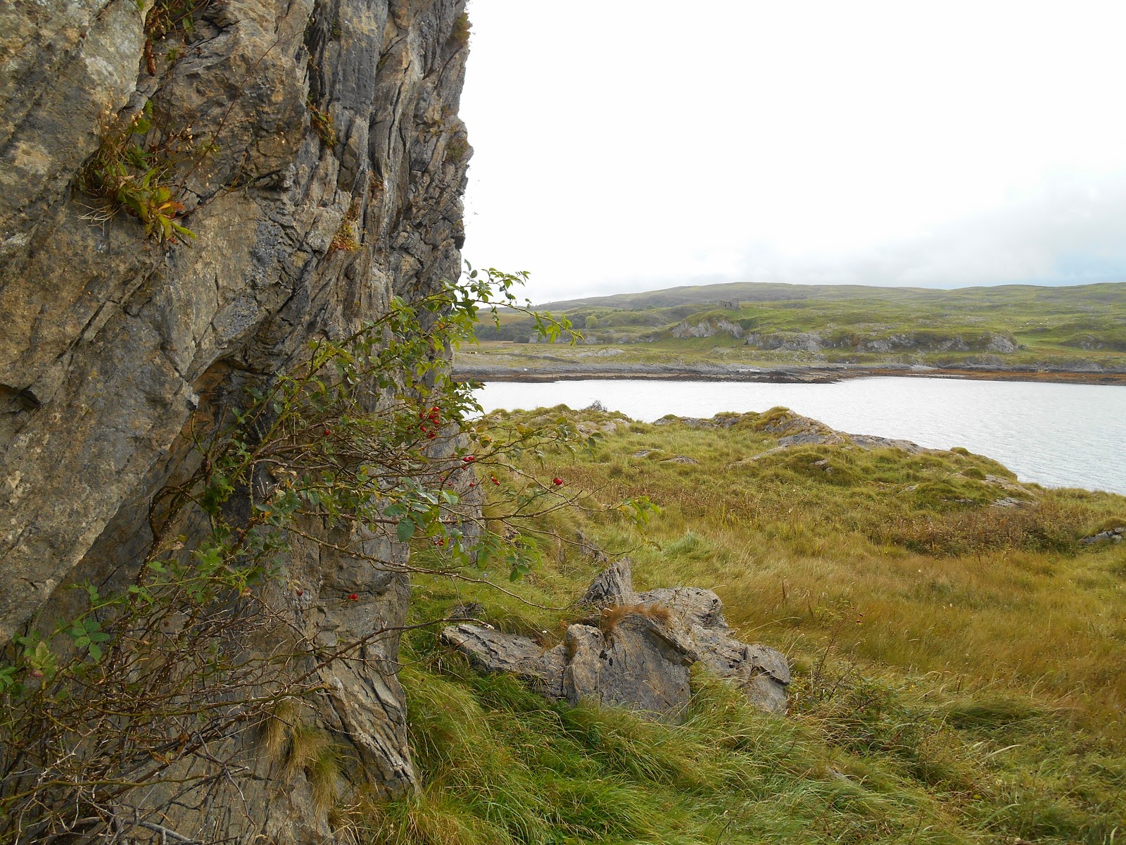
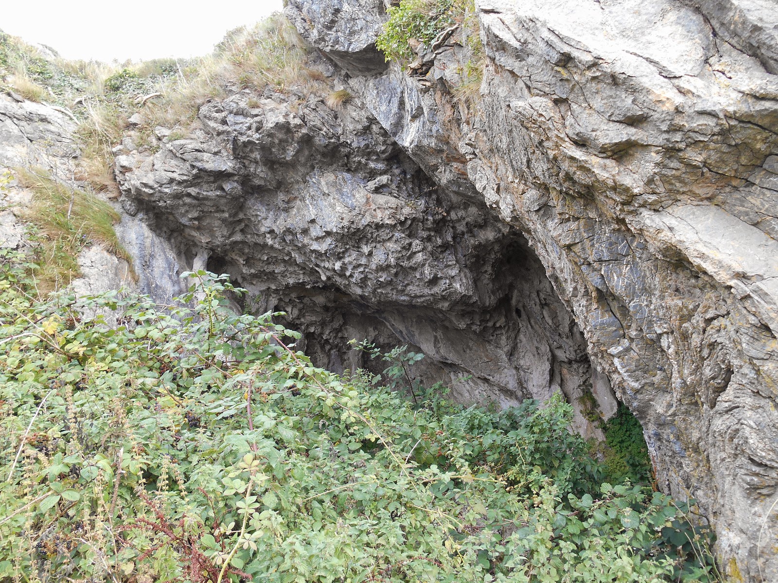
Unusually for this part of the Hebrides Lismore is composed of Dalradian limestone, which has been formed into shallow longitudinal valleys.  This makes the soil exceptionally fertile and the name Lismore means Great Garden in Gaelic.

Caledonian MacBrayne runs a vehicle ferry from Oban to Achnacroish halfway down the east coast of Lismore.  I had great difficulty at Oban locating the Lismore Ferry departure point, as the main notice had been removed.  Having driven round and round I was eventually directed to it.  Quite how you are supposed to know where it is when the car park has been closed off and there is no notice, I don't know!  Be warned it isn't cheap if you want to take your car for the day - it was £6.60 for me but £55 for the car.  However the island is a bit too big to explore on foot if you have only got a day to do it in.

There is also a passenger ferry which operates between Port Appin on the mainland and the northern tip of Lismore.  Mine was the only car on the Calmac ferry and there were 2 other foot passengers.  However when I drove to where the passenger ferry departs I counted 37 cars parked there, so presumably this is a popular way (and cheaper?) way to get to the mainland.  As the population of Lismore in the 2011 Census was only 192 and presumably they don't all have a car each, that was a large proportion of the island's cars parked in one place.  The roads on Lismore are all narrow, so I was grateful that most of the residents had left the island for the day, as it meant that I didn't meet too many other vehicles and have to reverse back to a passing place.

This was the last island to which Calmac run a ferry, which I had not visited.  I am not sure why it took me so long to get round to it.  It is a pleasant island but it doesn't have much to attract tourists, other than walkers.  I walked a mile from the end of the road to Achadun Castle on my way to visit the tidal island of Bernera.  Achadun Castle was probably built by the MacDougalls in around 1290.  It is now ruined.   There were a couple of signs showing the way to the castle from the end of the road but I would recommend visitors to Lismore come with an Ordnance Survey map.

As I got back to my car it started to rain and it didn't stop for the rest of the day.  If the weather had been better I would have made the effort to visit the ruined broch on the east coast at Tirefour and the other ruined castle on the west coast - Castle Coeffin.  

St Moluag, a contemporary of St Columba, founded a monastery on Lismore between 561 and 564 AD.

Lismore was the seat of the Diocese of Argyll from the 13th century until 1507 when it moved to Sadell in Kintyre.  A small cathedral was built on the island.  It was burned down at the time of the Reformation but the remains of the choir became the walls of the present church in 1749.

There are quite a few trees (e.g. sycamore, ash, hazel, chestnut, birch and hawthorn) on Lismore, particularly in the sheltered valleys and on the east coast but the woodland is not natural.  The natural woods were cleared from the 17th century.  Red and pink fuchsias have naturalised in the hedgerows.

Hedgehogs were introduced to the island in the late 1980s, possibly for slug control purposes.  They are now numerous.  I didn’t see any live ones but there was a squashed one on the road.


 Achadun Castle
 
Memorial Cairn to Jozef Kijowski at Achadun Castle
He was an immigrant from Poland who donated the castle and the surrounding land to the people of Lismore as a thank you for the kindness he received from the Scottish people.

 Achadun Castle
 
 Ruined mill

 Shop and Post Office
in the middle of the island.  The shop was well stocked.
 Old croft house at the Café and Museum

 Lios Beag Cafe and Museum
This is located in the middle of the island.  When I visited on a rainy Monday lunchtime in late September most of the other customers seemed to be local.  There were 2 other visitors exploring the island on bikes.  The man looked keener than the woman to leave the warmth of the café to continue exploring in the rain!  I had soup and coffee cake, both of which were delicious.   The Museum is well worth a visit.  It is free but they welcome donations.


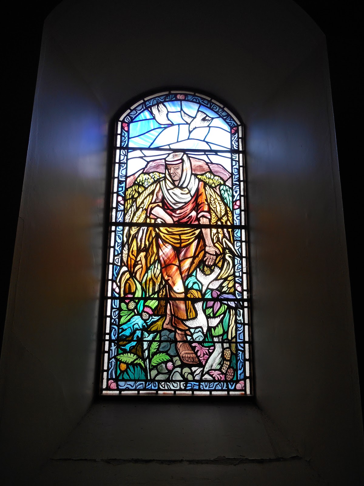
 Parable of the Sower Stained Glass Window in the Church

Church

 War Memorial

There is a sheltered anchorage at Port Ramsay on the north west coast of Lismore and lime was formerly shipped out from here.  The limeburners' cottages still line the waterfront but the lime burners are long gone.  Limestone was formerly quarried at An Sailean further down the west coast.  Port Ramsay was my favourite place on Lismore.
 
 Disused Lime Kiln at Port Ramsay

 Top of the disused lime kiln at Port Ramsay - a handy landfill site!

North east coast of Lismore looking north towards from where the passenger ferry departs.


 Strange currents at The Point, looking towards Port Appin

 Poorly pier at Achnacroish

 Achnacroish
The island's primary school is located here.

The Calmac ferry returns to pick me up at Achnacroish. 
 It is still raining and I am glad to leave!


 Lismore Community Hall

Tuesday 28 October 2014

Island 258 - Fraoch Eilean Beag, Gruinard Bay, Highland

Fraoch Eilean Beag is a small rocky tidal island on the eastern side of Gruinard Bay.  Gruinard Island in the middle of the bay is of course famous for having been used by the Ministry of Defence for experiments with anthrax as a bio-weapon.  It remained out of bounds until 1990 when it was declared safe 4 years after the island was soaked in formaldehyde solution.

Fraoch Eilean Beag has a larger neighbour immediately to the west - Fraoch Eilean Mor.  It looks on the OS maps as though Fraoch Eilean Mor should be accessible on foot at low tide.  However the day I visited it was a neap tide and it wasn't.

It was a bit of a scramble up on to Fraoch Eilean Beag over some slippery rocks.  There was a barely discernible path round the south side, which I followed.  The island is covered in heather, grass, bracken, brambles and a lone pine tree. When I visited in September 2014 lots of devil's bit scabious flowers were in bloom. 

 Fraoch Eilean Beag

 Fraoch Eilean Mor and Fraoch Eilean Beag on a misty morning

Eilean an Tuirc from Fraoch Eilean Beag

Island 257 - Eilean an Tuirc, Gruinard Bay, Highland

Eilean an Tuirc is a small rocky tidal island on the east side of Gruinard Bay.  From the Ordnance Survey map it isn't clear that it is an island but when I reached the beach called Camus Gaineamhaich I could see that it is cut off at high tide.  There was seaweed strewn across the narrow gap between it and the mainland.

Having got up very early in Gairloch to be at Gruinard Bay for the low tide I then encountered a problem that I hadn't anticipated - thick fog.  I parked in the car park at the south east end of the bay and started to walk the half a mile or so up the beach.  Visibility was about 100 metres, so I couldn't see this island or its neighbours to the north.  However the day I visited it was a neap tide and there was a little headland sticking out which I couldn't get round without getting my feet wet.  I returned to my car and drove north up the road and eventually spotted a place to park next to a stile.  There was no signpost but there was a lone flip-flop hanging on the fence.  I deduced that this probably meant the footpath led to the beach, which it did.  When I arrived on the beach visibility had improved slightly.

The beach is an attractive orange colour with crushed shells distributed across it.    Eilean an Tuirc is covered in trees, heather, rough grass and bracken.  I also found plenty of blackberries to eat.


Eilean an Tuirc in the morning mist
 Looking south from Eilean an Tuirc

Eilean an Tuirc

 Mainland from Eilean an Tuirc

Eilean an Tuirc

Monday 20 October 2014

Island 256 - Eilean Tioram, Redpoint, Highland

There are several Eilean Tiorams.  This one is located a mile to the south of Redpoint.    The name Eilean Tioram means "Dry Island", so I assumed it would be easy to access.

The OS Explorer map shows a track from Redpoint to Diabeg and I was relieved to see a signpost to this effect in the car park, as the track goes through the middle of a farmyard.  There were some warnings on the gate about cattle and farm dogs.  There was no sign of either on my way there.  For the first half a mile or so the track is very clear but then it disappears.  However by this time I could see the beach and Eilean Tioram and so headed straight for it across the dunes.  The sand on the beach was an attractive pale red/orange and there were a couple of seaweed free access points onto the island.

Eilean Tioram is uninhabited but is a delightful place to sit and stare for a while, which is exactly what I did.  I had the island to myself, which is how I like it.  It was a very calm slightly misty morning with no perceptible breeze and the only sounds were the water gently lapping at the rocks and the distant hum of a small boat's engine.  There were a few seabirds sitting on the water and occasionally diving down.   The mist cleared and the sun came out as I sat and ate a Tunnock's caramel wafer.  

The island is mainly covered in grass with a few wild flowers like thrift.  It is clearly grazed by sheep, as their droppings were scattered over the island but there were none present when I visited.

The beach at Red Point and Eilean Tioram feature in the 2014 film What we did on Our Holiday starring Billy Connolly, Ben Miller, David Tennant and Rosamund Pike.  In the film Gordie, played by Billy Connolly, dies on the beach while spending the afternoon with his three young grandchildren. They make a raft, put his dead body on it, set fire to it and send it out to sea in a Viking style funeral, which he requested, much to the horror of their parents when they found out what has happened.

After visiting the island I walked along the beach and had a look around a ruined fishing station before walking back the way I had come.  By this time both the cows and the farm dogs had appeared but thankfully the cows weren't interested in me and the dogs were behind a fence, although barking furiously. 

It was the day of the Scottish Independence Referendum and I passed a couple of polling stations but there were certainly no people queuing to cast their votes.  However every lamppost had a yes or no or sometimes both yes and no banners on them.

Looking east from Eilean Tioram towards the ruins of the Fishing Station

Eilean Tioram from the old fishing station

 Ruined fishing station with Eilean Tioram in the background

Sgeir Ghlas from Eilean Tioram

Looking east from Eilean Tioram

Eilean Tioram

Wednesday 15 October 2014

Eilean Tioram/Dry Island, Badachro, Gairloch Highland

On the Ordnance Survey Explorer map this island is called Eilean Tioram, which means "Dry Island".  The owner, who rents out 2 holiday cottages and a small bothy on it, calls it Dry Island.  It is unique in my experience in the UK because access to it is via a "floating bridge".  This does just what it says and floats as the tide rises.  It is located 5 miles by road from Gairloch.

Sadly I wasn't able to visit it, as there were a few too many "Private Property" notices for even me to ignore.  However I there wasn't one at the top of the hill by the road, although there is a gate.  I walked down the path to the shore where there is another gate saying "Private" and another "Private" notice further along at the mainland side of the bridge, so I just took a few photos and beat a hasty retreat before anyone noticed I had walked down the private path!  I picked up a leaflet by the parking area at the top and disturbed a resident earwig, who was busy eating it!  The properties available for holiday lets are The Old Curing Station and the Otter Cabin, which both sleep 2 people and the Bothy, which is a wooden cabin and I think it sleeps 4-5.  They all look lovely.

 Floating bridge to Dry Island at low tide

Floating bridge and Dry Island in the early morning mist

Island 255 - Slumbay Island, Lochcarron, Highland

Slumbay Island is located at the south end of the hamlet of Dalacladdich, which is half a mile south of the village of Lochcarron.  The only unlovely thing about it is its name.  It is 400 metres from east to west and 200 metres from north to south.  The highest point on the island is 32 metres above sea level.  It is joined to the mainland by a narrow neck of grass covered land. However there was seaweed strewn across the whole of it, so I concluded that it gets covered for a short while quite regularly by spring high tides.

I visited on a calm benign sunny September afternoon and had a lovely stroll along a path on the north coast of the island to the far end of it.  The island is uninhabited.  The higher parts are covered in trees - birch, rowan, sycamore, alder and hazel.  On the western side there is a small cliff.  The eastern end is lower and covered in grass, gorse, heather and bracken, interspersed with wildflowers like scabious, mint, sea mayweed and tormentil.

 Eastern end of Slumbay Island

 
Slumbay Island from Lochcarron

 Lochcarron from Slumbay Island


 Lochcarron from the eastern end of Slumbay Island

 Slumbay Island at low tide