Mousa is home to the best preserved Iron Age broch in the world. I am glad that I didn't visit the island on my last visit to Shetland in 1978 because all the many brochs I have seen since then elsewhere in Scotland wouldn't have seemed so impressive if I had seen this one first. I come from a town with the longest pleasure pier in the world (Southend-on-Sea) - 1.25 miles long - and although I have visited many better preserved or prettier piers, they are always slightly disappointing because they aren't nearly as long as Southend's.
Mousa Broch is over 2000 years old and 13 metres high. It is pretty much complete apart from a few courses of stones at the top on one side. You can climb right to the top up a stone spiral staircase, which is built between the two concentric walls but it is very dark. Torches are provided but you also need both hands to use the handrails, particularly on the way down. The original purpose of brochs isn't fully known but it is likely that they were used for defensive purpose, as status symbols and for day to day living.
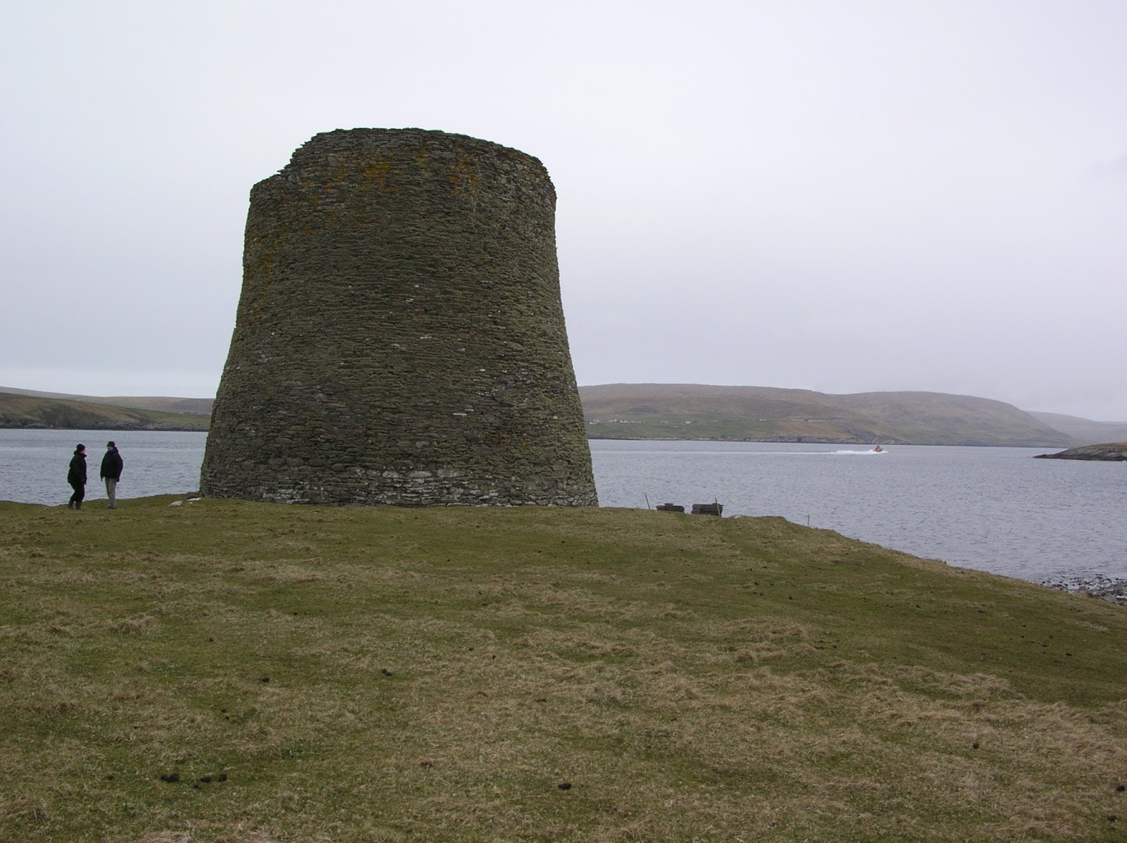
Mousa Broch

Mousa Broch
 Inside the broch
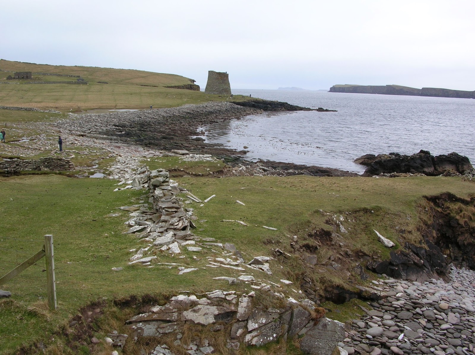
 Looking south across Burgi Ayre towards the broch

The name Mousa means Mossy Isle in Old Norse. The island has the largest breeding colony of storm petrels in Europe. During the day these tiny seabirds feed out at sea. They only return to their nests in the cavities of the broch walls and on the nearby boulder beaches and walls under cover of darkness to evade predators. Evening boat trips to Mousa are run from late May to mid July to watch the storm petrels return to their nests.
Other seabirds that can be found on Mousa are black guillemots, shags, eider ducks, arctic terns, arctic skuas and great skuas. There are also breeding colonies of grey and harbour seals. We didn't see any otters but they are obviously around, as one of the RSPB volunteers, who had come across on the boat with us to do some path maintenance, found some otter spraint (faeces) and offered it round for us to smell! That was an offer I couldn't refuse but it isn't as weird as it sounds, as it actually smells quite pleasant. It is sometimes described as smelling like violets. I wouldn't go that far but it does have quite a sweet smell. We did hear a snipe making a strange drumming noise, which was a first for me.
There are several burnt mounds on Mousa to the north of the broch. These are piles of fire cracked rocks surrounding a stone lined trough. This may have been used for cooking, as a sauna or possibly for tanning leather. We looked for these but obviously not hard enough because we didn't find them here or the following day on Noss. The ruins of a horizontal water mill can be seen near the broch.
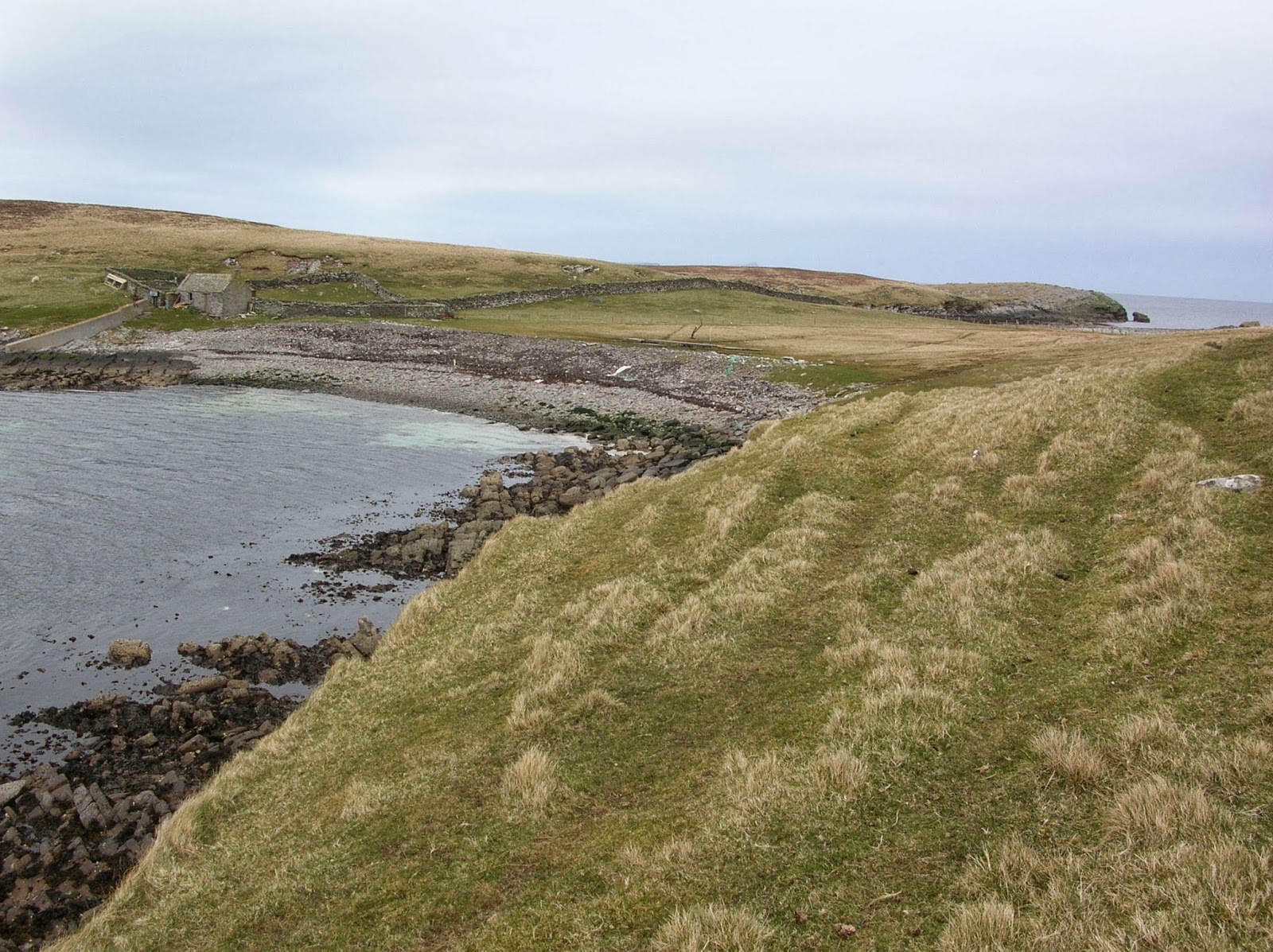
Mousa was inhabited from Neolithic times. In 1771 there were 11 families living on the island but by 1853 it was uninhabited. The remains of The Haa can be seen to the south of the broch. It was built in 1783 for a Lerwick merchant called James Pyper. The ruins of Knowe House, which was the farm for The Haa can also be seen. This was home to James family until 1842.
Many boats have been wrecked around Mousa's coast. In 1853 a French lugger on its way to Iceland called Le Jeune Alphonse was wrecked. In 1930 the SS St Sunniva was wrecked on Muckle Bard near the West Pool. In 1942 the SS Murrayfield, an armed merchant ship, was wrecked on Perie Bard off the east coast of Mousa. A lighthouse was moved from Noness Head on Shetland Mainland to the Perie Bard c1950.
There is no toilet on the island or any shelter but there are both at Sandsayre Pier. There is an excellent exhibition in an old boatshed at Sandsayre with information about the social and natural history of Mousa.

Mousa from Mainland

East Ham, Mousa

The 60 degrees north line of latitude runs through Mousa. Perie Bard from west coast of Mousa

Perie Bard from Mousa
 The ruined Haa
 West Ham, Mousa


The boat lands at a jetty in this bay

This beach was once used for drying fish.


No comments:
Post a Comment